|
|
|
Now linking to a new video at youtube.com: |
|
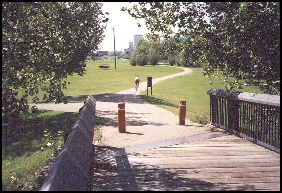
This 6 minute video takes you on the tour of the south-west river paths near Fort Edmonton park. It is an easy cruise because the paths in that area are fairly level and new.
|
|
Beginning in north-east Edmonton: |
|
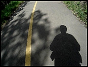
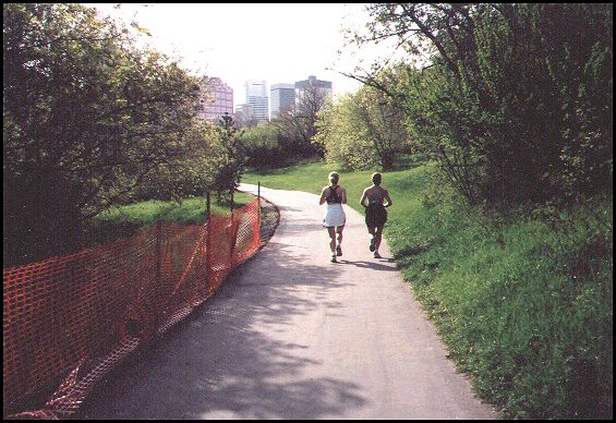
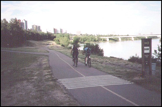
This inline skater is coming from where we're going. The journey starts in north-east Edmonton and takes us through this area in Hermitage Park. Then we go under the Yellowhead bridge, which is seen above in the distance and in the photo on the right side of your screen. (74 kb) |
This is one of a number of small lakes in Hermitage Park. Many of the parks in Edmonton have signs explaining the natural environment. From here, we go under the Yellowhead bridge and up a steep hill to the viewpoint which is shown directly below. (62 kb) |
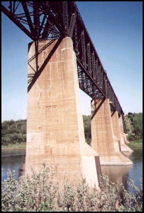
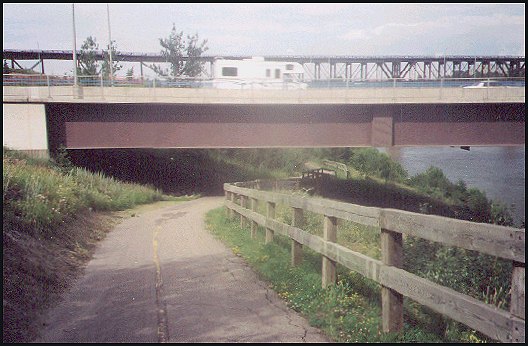
The path takes us under the Yellowhead bridge and gives us an impressive close-up view from underneath. (41 kb) |
|
From the Yellowhead bridge, we climb a steep hill which takes us under this road, up to the viewpoint that you can see in the next photograph. (54 kb) |
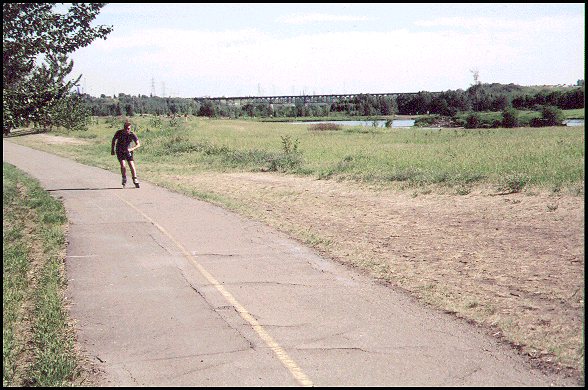
From this viewpoint, our path goes down a steep hill (on the right), and then appears in the distance below in the center of this photo. The next photo shows Strathcona Science park. That park is in the top left part of this photo. The park has a path which comes down a hill and crosses the North Saskatchewan River on the bridge on the left and joins up with the path we're on. From there, the path runs to the right and then west towards the city centre. (59 kb) |
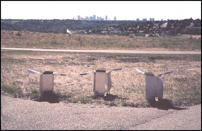
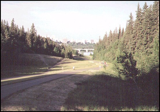
The Strathcona Science Park is the most easterly point of the Edmonton pathway system. Here, we have a view of the city core in the distance, and of three pieces of art. The white spot left of center and over the hill is the water fountain in Rundle Park. (67 kb) |
|
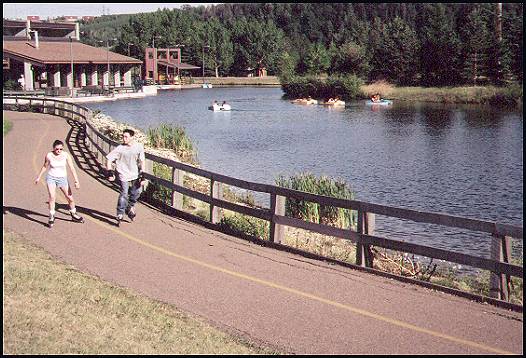
Now we pass through Rundle Park. The large pond on the right is where people rent paddle boats. The fountain which is seen in the last photo is immediately behind us. (51 kb) |
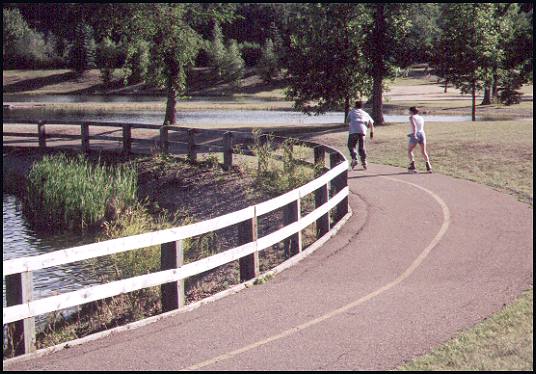
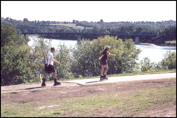
These skaters are on their way through Rundle Park. (48 kb) |
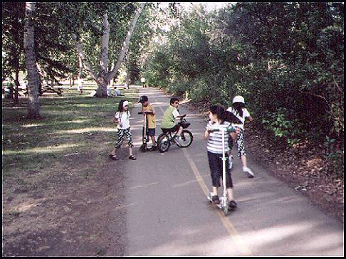
Sometimes Rundle Park can get busy. We have to be ready to slow down for the more important traffic, children playing on their skooters. (49 kb) |
|
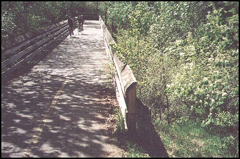
This footbridge joins Rundle Park and Goldbar Park. Like most bridges in Edmonton, it has a wooden walkway. Although it looks a little rough for the inline skater, I found that when I took it slow it was okay. Wood is great for walkers. (57 kb) |
The path provides an easy run through Goldbar Park. This park has lots of open area and a small artificial lake. (67 kb) |
|
Running through some rugged country: |
|
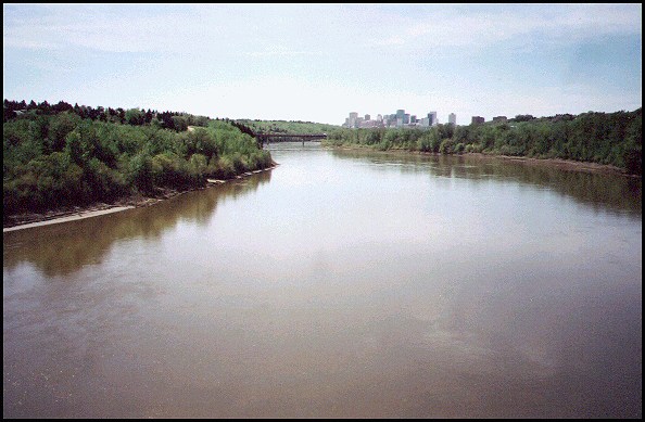
At Goldbar Park, we take a detour onto a footbridge next to the path to get this view of the North Saskatchewan River with the Edmonton core still in the distance. Part of the path we are using can be seen as a white spot at the top of the hill just to the left of the river. (64 kb) |
Below here, the Wayne Gretzky Freeway crosses a bridge. The path shown in the photo on the right goes down a hill to the left of this viewpoint, then under the bridge below, and continues through the trees in the distance on the South (left) side of the river. The deciduous trees in the distance are part of a golf course. (68 kb) |
The path winds down this hill from the viewpoint in the last photo. In the distance, it goes over a small hill, turns left, and then down under the freeway bridge. (83 kb) |
|
The path continues through some trees which give us some cool shade. (67 kb) |
This is the Riverside Golf course, located by the river. It was probably here first, so the path has to take a safer route, up a steep hill to the left. (43 kb) |
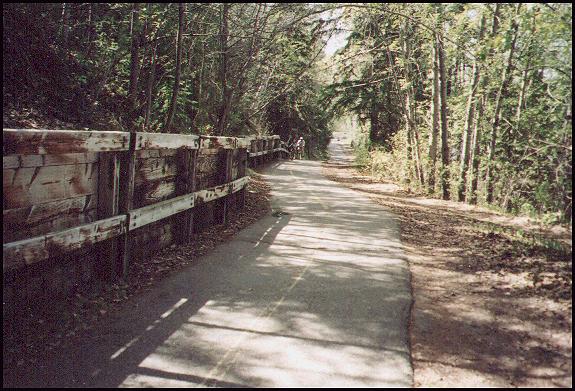
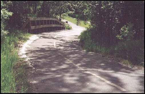
This bridge crosses a ravine. The trees on the right prevent us from seeing that it's a long way down to the golf course. This bridge eliminates one difficult hill. (64 kb) |
|
Paths near the downtown core: |
|
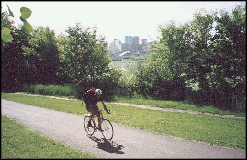
When we came out of the bush at the top of the hill, we were on the path below. The path circles up onto the bridge where we get this view. (60 kb) |
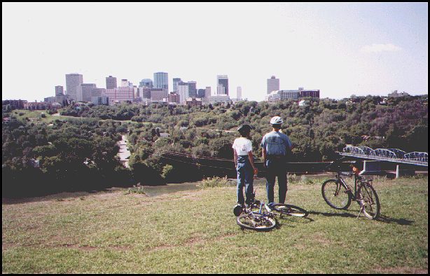
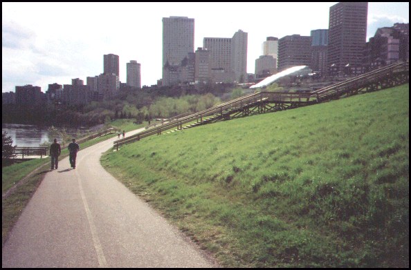
From that bridge, we have an easy run to a place where we can view the city core. (66 kb) |
These bikers have stopped to relax and enjoy the view which looks west at the valley and city skyline. (44 kb) |
|
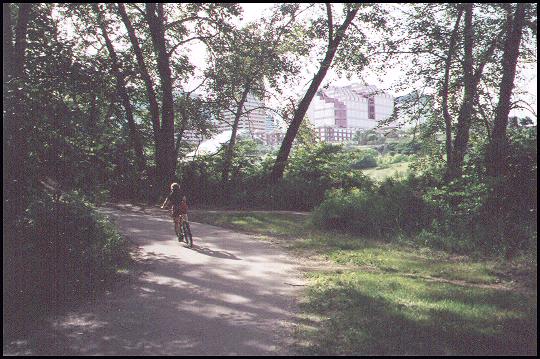
After heading south we run down a long steep hill. Here we are approaching the bottom. The cyclists riding on the grass at the bottom of the hill give us a better sense of how steep the hill is. (69 kb) |
At the bottom of the hill, a biker flies by as we experience a new view of the city core. (62 kb) |
After heading west it isn't long before we are running through the trees with the downtown city skyline above. (58 kb) |
|
The path takes us under two bridges, then we climb up to this point. Here, we are looking back at the city skyline. (67 kb) |
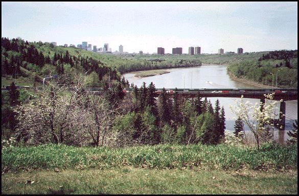
Soon, we can look west and see this view of three bridges. The path on the north side of the river can be seen just above the trees on the opposite bank, on the right. (58 kb) |
|
|
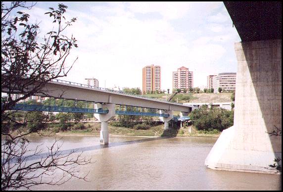
After coming down a hill, we have this view. In the distance, on top of the High Level bridge, we see an old street car which gives tourists a ride in the summer. (46 kb) |
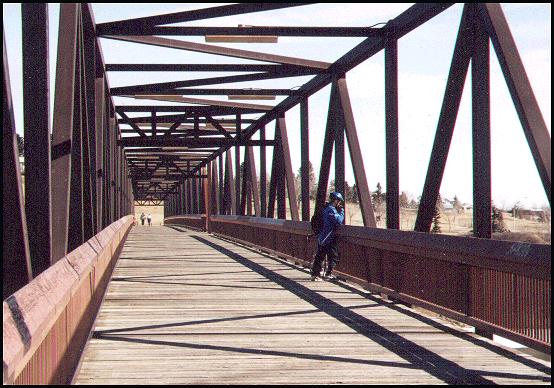
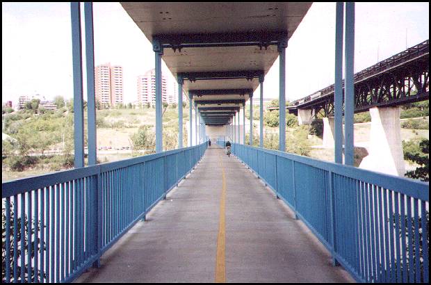
We get to the north side of the river by using this pedestrian path. It crosses the North Saskatchewan River under the LRT (light rail transit) bridge. The massive High Level bridge is on the right. (49 kb) |
Here is the walkway that crosses the river under the LRT tracks. The High Level bridge, which was built in 1913, is on the right. After crossing the bridge, we turn left and head west. (49 kb) |
|
Paths on the north side of the river |
|
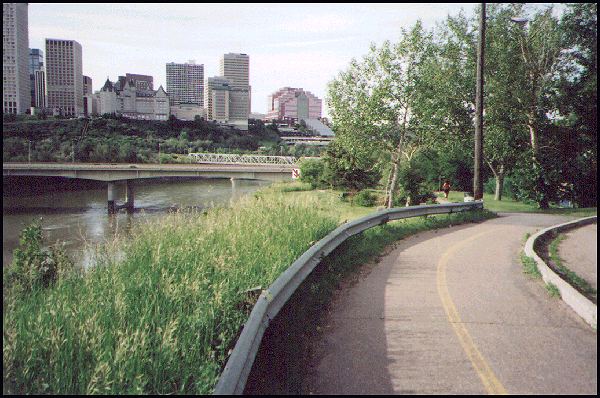
There is also a pathway on the north side of the river which starts and runs through a park which is just east of the city core. These people could have avoided the broken pavement by taking a short paved detour. (66 kb) |
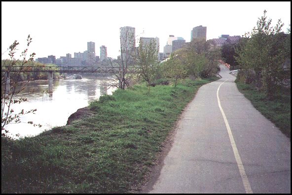
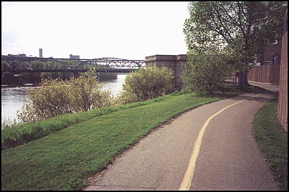
As the path approaches the city core, we can see the Edmonton Queen paddlewheeler. The footbridge on the left connects the paths that run along the north and south side of the river. (57 kb) |
These runners are also approaching the city core from the east. (68 kb) |
|
The path runs through the Louise McKinney Riverfront Park, just below the city core. The bright building on the right is the Edmonton Convention Centre, before it's expansion. (45 kb) |
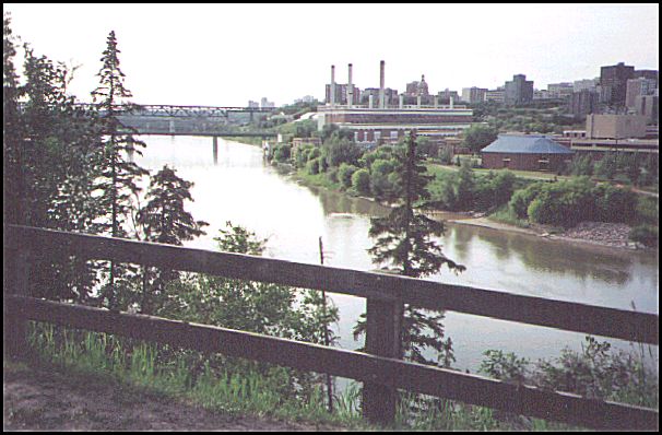
After running through some trees, the path turns the corner by a power plant, and here we see the 105th Street bridge on the left and the High Level bridge in the distance. (59 kb) |
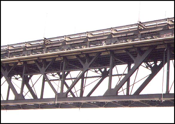
A cyclist on the high level bridge, as seen from the LRT bridge. (45 kb) |
|
Finishing on the west side of Edmonton: |
|
This view from the west side of Edmonton is looking back east at the apartments which are on the west side of the city core. The Groat bridge is on the right. In 2006 the path system was extended across the Groat bridge and into the south-west part of the city. (58 kb) |
This is a similar view of the city core, looking back east from half way up the MacKinnon Ravine, on the west side of the city. The Groat bridge is seen in the distance. (66 kb) |
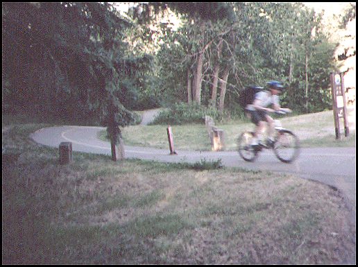
The path winds up a hill and ends on the west side of Edmonton, at the top of the MacKinnon Ravine. This guy is just a blur because he is crossing the finish line about ten times faster than I did on inline skates. (58 kb) |
2002 - While a full trip across Calgary took me roughly 4 hours, a similar trip which crossed Edmonton on the 2002 paved paths from west to north-east took 3 hours. Edmonton has a deeper and rougher river valley, so it's path system is more rugged and challenging. Calgary has two hills to climb and run down. Edmonton has at least four steeper and longer hills, depending on the route that is taken. Unfortunately, the Edmonton hills put a lot of wear on the noisy breaks of inline skaters, so the the main developments that are now happening are designed to improve the river valley for bikers. Most Edmonton inline skaters make shorter runs and make use of the flatter paths which run next to the river.
2005 - Edmonton is currently building an additional 10 km of paved path which stretches into the south-west part of the city.
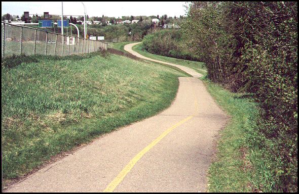
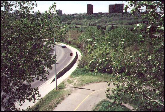
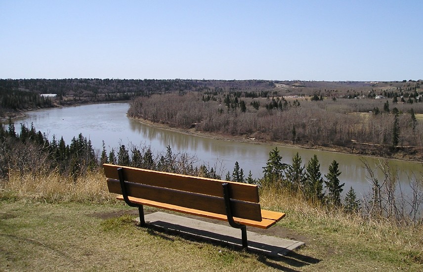
2006 - The new south-west leg of the path crosses the Groat bridge, and follows the road up the hill on the south side of the river. It follows the road along a ridge above the river and soon you come to this viewpoint.
This view of the southwest river valley
where the bike path runs was taken on
April 23, 2006 with my new camera.
(The 164 kb enlargement will fill your screen.)This view gives you an idea of the route the path takes. In the distance, on the far left of this photo the path goes down the hill, passes the building (a horse barn) next to the river and continues to the right, then under Whitemud Drive. Immediately above the right side of the bench, next to the sky, you can see Whitemud Drive. A new video (which has links below) begins under the Whitemud Drive bridge and takes a tour of that area, including the part beyond, next to Fort Edmonton park where the path currently comes to an end. All of what you see is located within the city of Edmonton.
|
This 6 minute video takes you on the tour of the south-west river paths near Fort Edmonton park. It is an easy cruise because the paths in that area are fairly level and new.
|
|
To Calgary paths [A Jolly Good Journey for Inline Skaters]. |
Posted November 12, 2002. Since January 1, 2004 you are guest .